


Registro Nacional - Catastro Nacional Filings
Plano G-1451804-2010 (16.248 Hectares) Registered with the Catastro Office on October 5, 2010 is directly below and this registration modified Plano G-00077726-1969.

Plano G-1473651-2011 (41.5117 Hectares) Registered with the Catastro Office on January 24, 2011 is directly below and this registration modified Plano G-1045967-2006. Plano G-1458780-2010 (66.5681 Hectares) Registered with the Catastro Office on November 5, 2010 is directly below and this registration modified Plano G-00077725-1969

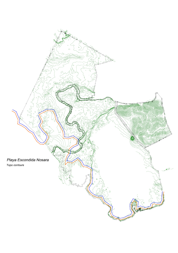
The Topographical images of all three properties conjoined is below. Orange lines indicate the official registered I.G.N monuments (majones) in place that mark the mangrove limits and the blue lines indicate the construction set back from the majones.
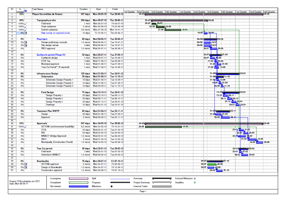
Below is the Time Line for complete development from the beginning of 2010 up to the SETENA approval of the Land Plan (environmental feasibility approval) received January 2011 through to the end of the permitting process. Work to obtain the balance of the approvals needed is ongoing.
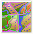
Interactive Map
Click here to view our interactive map with detailed information on all phases of Playas Escondidas Nosara

Explore Paradise
Click here to visit our extensive photo gallery of the property and surrounding areas, wildlife, and vegetation.