


Hidden Beaches of Nosara Maps

Satellite Photo with Hidden Beaches of Nosara (RED Outline), Nosara area (GREEN Outline), 3500 foot airport runway (BLUE Box Outline) and Bridge over the Nosara River (BLUE Circle).

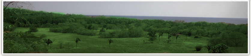
Nosara area from Ostional to Samara with the Hidden Beaches of Nosara Area outlined in red.

Hidden Beaches of Nosara (HBON) is outlined in red and the yellow line is the road that HBON improved that could become the year round coastal road as soon as a bridge is constructed over the Montana River.

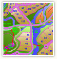
Hidden Beaches of Nosara (HBON) is outlined in red. The Current Coast Road is in yellow. The Montana River is the blue dotted line. The white circle is the location of a public bridge that could constructed over the Montana River. The green line is the 2km road that HBON improved to its north that is that actual coastal road and will become the quickest north south route from Ostional to Nosara proper. The Red dots indicate where the electric was before HBON brought power into its property. The Green Box is the concrete bridge over the Nosara River.

Google Earth view of Playa Nosara, Playa Pelada, Playa Guiones and Playa Garza. Starting from left to right, Playa Nosara is between the red arrows, Playa Pelada is between the right red arrow and the left green arrow, Playa Guiones is between the green arrows and Playa Garza is between the blue arrows. Hidden Beaches of Nosara is the red outline adjacent to and in the middle of Playa Nosara.
Interactive Map
Click here to view our interactive map with detailed information on all phases of Playas Escondidas Nosara
Explore Paradise
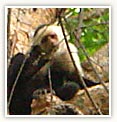
Click here to visit our extensive photo gallery of the property and surrounding areas, wildlife, and vegetation.